Bottom homepage
Dirt
Billiard Balls
Why Indeed
dirt 1
Alka-Seltzer
dirt 2
Fuzzballs
dirt 3
dirt
dirt 4
Cheetos

(Rust)
dirt 5
USGS
WTC7
(temp)
dirt 6
USGS2
dirt 7
humans
Appendix_1 Appendix_2 Appendix_3


WARNING: NOT YET FOR PUBLIC SHARING
(Please do not share until this warning is removed. Thanks!)


Molecular Dissociation: from Dust to Dirt

By

Judy Wood

This page last updated, May 21, 2007

This page is currently UNDER CONSTRUCTION
and is currently being updated.

[Note: References and Sources will be posted and figure numbers will be corrected (in sequential order) when this paper is finished .]

(originally posted: May 16, 2007)

Shortcuts (not added, yet)
Audio Files
A. USGS - Dust

B. USGS - Ferric and Ferrous Dust

C. USGS - Clays and other Materials Map

D. USGS - Organic Compounds Map

E. USGS
23 May 2007
Interview: Jerry Leaphart (hr 1) and Judy Wood (hr 2) are guests
of Jim Fetzer on "The Dynamic Duo"Listen to second half (mp3) [dirt1,2
]

25 May 2007
Interview: Judy Wood is the guest of Ambrose Lane on "www.weourselves.org"
Listen: One 25 min segment (mp3) or two (mp3-1, mp3-2) [dirt1,2,3,4
]

19 June 2007
Interview: Judy Wood will be the guest of Jim Fetzer (hour 2) on "The Dynamic Duo"
Listen to second half (mp3) [dirt4
]

20 June 2007
Judy Wood is the guest of Jim Fetzer on "The Dynamic Duo"
Listen (mp3) [dirt4 & WTC7 & "smoke rings" and "lathering up"
]

27 June 2007
Judy Wood is the guest of Jim Fetzer on "The Dynamic Duo"
Listen (mp3) [dirt3,4
]

 Map of Sample Locations
(click to enlarge)
image wtc.Sept16.2001.usgs.r091011.plume1+bw.lowermhtn.tgif.gif
Source


Link to USGS home page.

A. USGS - Dust
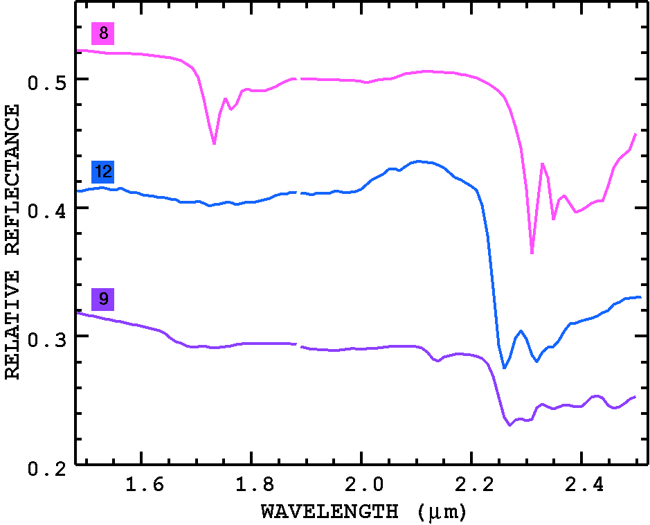
Source: http://pubs.usgs.gov/of/2001/ofr-01-0429/dustplume.html
OFR 01-0429: World Trade Center USGS Dust/Debris Plume Map

Maps of dust and debris show asymmetric distribution of materials.

The map images on this page (Dust Figures 1a, 1b, 2a, 2b) show locations of materials with spectral shapes similar to the spectra of field samples of dust and debris collected around the lower Manhattan area. These materials/minerals include common building materials; therefore, the maps may include materials in buildings not associated with the World Trade Center (WTC) collapse. While the minerals mapped in any one location may or may not be associated with the WTC event, a pattern is seen that appears to show the distribution of materials related to the WTC collapse. Further, the debris map qualitatively agrees with on scene observations 2 days after the imaging spectroscopy data were acquired. Production of a dust/debris map was challenging because building materials are similar all over the city (e.g. concrete occurs in many locations). However, the pulverized dust/debris does have some general spectral characteristics that can be used.

Spectra of the field samples shows a general range of spectral characteristics (Dust Figure 3). Samples WTC01-37B and WTC01-37Am are concrete that display ferrous iron absorptions (most likely due to the aggregate). The spectrum of concrete minus the aggregate is shown in sample WTC01-37A: the cement shows less ferrous absorption. Pervasive in the spectra of the debris is gypsum, and with the variations in abundance of other components, spectra of the dust and debris show the spectral variations seen in Dust Figure 3. We mapped for these general spectral shapes over the spectral range 0.5 to 2.4 microns. The ultraviolet was not included because scattering from smoke affects shorter wavelengths to much. The strategy proved effective. The maps should not be interpreted as indicating that these specific materials were mapped, only that the spectral shape is similar. However, red and yellow colors indicate areas showing more ferrous-like absorptions, and this is apparent in the WTC core zone where many steel girders dominate. Green copper roofs have a similar absorption to ferrous minerals, so they would map as red or yellow.

Two versions of the dust/debris map are shown (Dust Figure 1a, 1b, 2a and 2b). Dust Figure 2a, b is the same as Dust Figure 1a, b but without the grey-scale image background. Dust Figure 2a, b allows one to see the mapped materials without the apparent clutter of the grey-scale image.

The plume map in Dust Figures 1 and 2 indicate an asymmetry in the dust/debris distribution, with more iron bearing materials to the south by southeast. It is difficult to locate the outer boundary of the dust/debris because of the problem of matching common materials throughout the city.

The reference spectra used for matching the dust/debris was:
wtc01-37B (Note the strong Fe2+ absorption near 1-um.)
wtc01-37Am
wtc01-37A
wtc01-15
wtc01-28
wtc01-36

Dust Figure 1a. Dust/Debris plume map. Dust Figure 1b. Dust/Debris plume map, same as at right, but zoomed in to lower Manhattan.

Dust Figure 2a. Dust/Debris plume map without the image background so the mapped materials are easier to see. Dust Figure 2b. Dust/Debris plume map, same as at right, but zoomed in to lower Manhattan.

Dust Figure 3. Reference spectral shapes used for making the dust/debris map. The colors match the colors on the maps in Dust Figures 2, 3.


DISCUSSION, HERE.
 Map of Sample Locations
(click to enlarge)
image wtc.Sept16.2001.usgs.r091011.plume1+bw.lowermhtn.tgif.gif
Source
image wtc.Sept16.2001.usgs.r091011.1um.18fe+bw.tgif.gif
Dust Figure 1b. Dust/Debris plume map, same as at right, but zoomed in to lower Manhattan. Dust Figure 2b. Dust/Debris plume map, same as at right, but zoomed in to lower Manhattan.


B. USGS - Ferric and Ferrous Dust
Source: http://pubs.usgs.gov/of/2001/ofr-01-0429/feats-1um.html
OFR 01-0429: World Trade Center USGS Ferric-Ferrous Map

Images of the World Trade Center site show significant patterns of materials with spectral absorptions near 1-micron.

The images on this page (Iron Figure 1, 2) show locations of materials with ferric and ferrous absorption features. These materials/minerals may include common building materials; therefore, the map may include materials in buildings not associated with the World Trade Center (WTC) collapse. While the minerals mapped in any one location may or may not be associated with the WTC event, a pattern is seen that shows the distribution of materials related to the WTC collapse. This is because the debris from the collapse tends to appear contiguous near the WTC or in patches unrelated to the layout of roads and buildings. Building materials that map with sharp boundaries as roads and building shapes may not be WTC debris.

Fe-bearing materials occur in the WTC area and appear to be distributed in and around the collapse zone. Materials that were mapped show absorption features indicative of both ferric (Fe3+) and ferrous iron (Fe2+). Many minerals have similar ferrous absorptions, so maps show only the presence of Fe-bearing minerals and not specific mineralogy. In the maps below, the ferric and ferrous materials are identified only by numbered color. Pixels mapped as each numbered color indicate similar absorption position and shape and are likely similar in composition, but that composition is not generally a unique identifier of mineralogy.

The ferric absorptions are interpreted to be due to hematite (Fe2O3 - iron rust), or goethite (FeOOH). The red coatings on iron beams seen in news reports and by are field team are consistent with hematite or goethite.

Fe-bearing minerals are common in the aggregate in concrete. The Fe-absorptions appear in spectra of the debris samples and are prominent in spectra of the concrete debris. To see laboratory spectra of the dust and debris samples, CLICK HERE.

The map shows an asymmetric distribution of debris that extends to the SSE of the site. Similar distribution patterns are seen on the debris map (see previous section Dust and Debris Plume Map.) and the vibrational absorption map (next section), indicating a consistent finding of asymmetric distribution. Iron Figure 2 is the same as Iron Figure 1 but without the grey-scale image background. The debris pattern is more obvious without the background.

The asymmetry in the iron-bearing materials map may be related to the asymmetry in the asbestiform minerals map. The AVIRIS data and the laboratory analyses of the field samples indicate a lower abundance of chrysotile in the the southern direction from the WTC, the same direction of the increase in iron-bearing materials. The implications of this distribution will be explored in the Integration of results and conclusions section, below.

Iron Figure 1a. Ferrous, ferric iron absorption features map. Iron Figure 1b. Ferrous, ferric iron absorption features map, same as at right, but zoomed in to lower Manhattan.

Iron Figure 2a. Ferrous, ferric iron absorption features map, without the image background so the mapped materials are easier to see. Iron Figure 2b. Ferrous, ferric iron absorption features map, same as at right, but zoomed in to lower Manhattan.


DISCUSSION, HERE.

"The ferric absorptions are interpreted to be due to hematite (Fe2O3 - iron rust), or goethite (FeOOH). The red coatings on iron beams seen in news reports and by are field team are consistent with hematite or goethite.

Fe-bearing minerals are common in the aggregate in concrete. The Fe-absorptions appear in spectra of the debris samples and are prominent in spectra of the concrete debris. To see laboratory spectra of the dust and debris samples, CLICK HERE. "


image wtc.Sept16.2001.usgs.r091011.1um.18fe+bw.tgif.gif
image wtc.Sept16.2001.usgs.r091011.1um.18fe+bw.lowermhtn.tgif.gif
Iron Figure 1b. Ferrous, ferric iron absorption features map, same as at right, but zoomed in to lower Manhattan. Iron Figure 2b. Ferrous, ferric iron absorption features map, same as at right, but zoomed in to lower Manhattan.

 Map of Sample Locations
(click to enlarge)
image wtc.Sept16.2001.usgs.r091011.plume1+bw.lowermhtn.tgif.gif
Source


C. USGS - Clays and other Materials Map
Source: http://pubs.usgs.gov/of/2001/ofr-01-0429/feats-2um.html
OFR 01-0429: World Trade Center USGS Vibrational Processes Map

Images of the World Trade Center site show patterns of materials with spectral absorptions due to vibrational processes.

The map on this page (Vibrational Figure 1) shows locations of materials with vibrational absorption features commonly found in clays and other phyllosilicates (like muscovite), carbonates, and water-bearing sulfates. Such minerals are commonly found in building materials. For example, walls are often constructed with a board containing gypsum, a sulfate. Gypsum has been identified in samples from the WTC area (see sample analysis section). Muscovite, carbonates, and other hydroxyl-bearing minerals have also been identified in the WTC samples (see the Integration of Results section).

The debris contains common building materials, therefore, the map also shows these materials in other buildings not associated with the World Trade Center (WTC) collapse. While the minerals mapped in any one location may or may not be associated with the WTC event, a pattern is seen that shows the distribution of materials related to the WTC collapse. This pattern matches the pattern from the ferric and ferrous absorption features map.

The spectral absorptions due to vibrational processes are normally diagnostic of mineralogy or material type. The spectral signatures in the WTC debris are, however, quite weak (see laboratory spectroscopy of field samples, below). Because of their weak strength, and influences of the spectral signatures of other materials, including organics, definitive identifications could not be made in this case. Definitive identifications might be made on such samples if the sensor had a higher signal to noise.

Both the iron maps, dust/debris maps, asbestiform mineralogy maps, and vibration absorption maps show a pattern of materials suggesting asymmetric distributions to the composition of the debris/dust.

Again, at any one location in the image, the mapped materials may be unrelated to the WTC debris because they may be common building materials used in the area. However, if a certain type of debris must be cleaned up, this and the other maps indicate the locations to investigate on the ground where similar compositions occur.

Vibrational Figure 1a. Vibrational absorption features map. Vibrational Figure 1b. Vibrational absorption absorption features map, same as at right, but zoomed in to lower Manhattan.


DISCUSSION, HERE.

image wtc.Sept16.2001.usgs.r091011.1um.18fe+bw.tgif.gif
Vibrational Figure 1b. Vibrational absorption absorption features map, same as at right, but zoomed in to lower Manhattan. Vibrational Figure 1b. Vibrational absorption absorption features map, same as at right, but zoomed in to lower Manhattan.

 Map of Sample Locations
(click to enlarge)
image wtc.Sept16.2001.usgs.r091011.plume1+bw.lowermhtn.tgif.gif
Source


D. USGS - Organic Compounds Map
Source: http://pubs.usgs.gov/of/2001/ofr-01-0429/feats-ch.html
OFR 01-0429: World Trade Center USGS Organic Components Map

Images of the World Trade Center site show patterns of materials with spectral absorptions indicating the presence of C-H (organic) compounds.

The map of materials containing organic compounds (Figure 1a, 1b) shows no pattern that is indicative of the distribution of debris from the WTC collapse at the detection limit of AVIRIS. Organic compounds include any material containing C-H chemical bonds (e.g. plastics, paints, gasoline, and many types of solvents).
Because there are literally thousands of organic compounds and our reference materials spectral library only contains a few samples, we do not have the capability to uniquely identify the various types of organic materials. Because the reference spectra covering the AVIRIS spectral range is sparse, it is also unknown if AVIRIS has the spectral resolution to uniquely separate some types of organic compounds. Thus the organics map here does not indicate unique compounds. But the different colors indicate different spectral classes of organics and indicate broadly similar compositions.

The majority of the organics mapped in this area are probably related to plastics and paints. Paper, wood, and vegetation are also organic, but the spectral signatures of these materials occur with other known absorptions (e.g. from lignin, cellulose, and nitrogen) and are excluded from this map. Some aged wood, however, does have spectral features that can be confused with the other organics here (e.g. due to decreased signatures of lignin, cellulose, and nitrogen), and might be included in this map.

Imaging spectroscopy has not detected more than a few percent organic material in the WTC debris. It may be possible that more organic material exists but was not spectrally observable at the surface with AVIRIS.

Absorptions due to CH occur near 2.3 microns: the same location as (OH) absorptions in serpentines and amphiboles (asbestiform minerals). This coincidence results in a higher threshold detection limit for asbestiform minerals when CH-absorptions are present in the spectrum. Fortunately, CH-compounds also have additional absorption features (e.g. those near 1.65 to 1.75 microns, Figures 2a, b, c) that make detecting such compounds possible and reducing false positive identifications of asbestiform minerals. Thus, locations on this map where CH-compounds are present also indicate locations where asbestiform minerals are indeterminate.

CH Figure 1a. Organic materials absorption map. CH Figure 1b. Organic materials absorption map, same as at right, but zoomed in to lower Manhattan.

CH Figure 2a. Example spectra of CH compounds used to map the organics in CH Figure 1. The colors of the spectra match the colors of the materials on the map.
CH Figure 2b. More spectra of CH compounds used to map the organics in CH Figure 1. The colors of the spectra match the colors of the materials on the map.
CH Figure 2c. More spectra of CH compounds used to map the organics in CH Figure 1. The colors of the spectra match the colors of the materials on the map.


DISCUSSION, HERE.
image wtc.Sept16.2001.usgs.r091011.1um.18fe+bw.tgif.gif
CH Figure 1b. Organic materials absorption map, same as at right, but zoomed in to lower Manhattan. CH Figure 1b. Organic materials absorption map, same as at right, but zoomed in to lower Manhattan.

 Map of Sample Locations
(click to enlarge)
image wtc.Sept16.2001.usgs.r091011.plume1+bw.lowermhtn.tgif.gif
Source


 Continue to next page.


Top homepage
Dirt
Billiard Balls
Why Indeed
dirt 1
Alka-Seltzer
dirt 2
Fuzzballs
dirt 3
dirt
dirt 4
Cheetos

(Rust)
dirt 5
USGS
WTC7
(temp)
dirt 6
USGS2
dirt 7
humans
Appendix_1 Appendix_2 Appendix_3


In accordance with Title 17 U.S.C. Section 107, the articles posted on this webpage are distributed for their included information without profit for research and/or educational purposes only. This webpage has no affiliation whatsoever with the original sources of the articles nor are we sponsored or endorsed by any of the original sources.

© 2006-2008 Judy Wood and the author above. All rights reserved.